3/24/2010

Goricko

We spent the whole day walking in Goricko. At the end of the day we came to the enormous Grad (the Castle), building with 356 rooms. But it was already dark and I couldn't take any pictures.
Close to Austria.

Ascending another hill.

Along the Austrian border. The farm in the picture is on the Austrian side.

.


Posted by Picasa

3/23/2010

Goricko

We were walking in the area very close to the Hungarian and Austrian border. It is part of the Central European Green Belt.
Hikers approaching the "Tromejnik".

At the "Tromejnik". Tromejnik is the stone indicating the point where three countries touch: Slovenia, Austria and Hungary.This picture is taken from the Hungarian side.

The picture taken from the Austrian side.


Posted by Picasa

Goricko


Goricko is part of Prekmurje, a rather undeveloped region of Slovenia. But it has good prospects for further developement of tourism based primarely on natural mineral and thermal waters. Speculators have been buying property (at present very cheap) and waiting for prices to raise.

Goricko in Trdkova.

Goricko in Trdkova - near the border with Austria and Hungary.

Goricko in Trdkova.


Posted by Picasa

Goricko

Goricko is a remote part of Slovenia. In the time of Yugoslavia it was a "forgotten area".
Old, traditional house in Trdkova.

Tree at the crossways.

Charateristic cross at the crossways.


Posted by Picasa

Goricko

It was the first day of spring. Hikers were in high spirits.
"Feel the warm breath of wind
caressing my face in the light
Feel my lungs and taste the air
spring is finally here"
Break in Trdkova.

First spring wild flowers: Primula vulgaris, primrose.

Traditional house.


Posted by Picasa

Goricko

Goricko where we were walking is a part of a large Nature Park Goricko - Raab - Orseg in three countries Slovenia, Austria and Hungary.
View from the hill with the Evangelical Church in Gornji Petrovci.

Traditional farmhouse.

Before the outburst of spring.

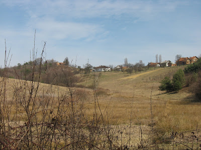
Goricko is a land of rolling hills and valleys.


Posted by Picasa

3/22/2010

Gornji Petrovci

We started out trail through Goricko in Gornji Petrovci and ended it in Grad. Three local guides led us from village to village mostly along hidden paths. We do not like asphalt roads.
Pine trees in Gornji Petrovci.

Hikers in Gornji Petrovci.

One of pot bellied pigs we saw on a farm in Gornji Petrovci.

The Evangelical Church on a hill (336 m) in Gornji Petrovci.


Posted by Picasa

Radenci - Murska Sobota

Yesterday (21 March) we were walking in Goricko, the most north eastern part of Slovenia. Our starting point was the village Gornji Petrovci. On the way to Gornji Petrovci we stopped for coffe and drink in Radenci and Murska Sobota.
Hotel Radin in Radenci. On the right is our bus. Radenci is a popular spa town.

Image of Murska Sobota.

The church of St. Nicholas in Murska Sobota, built in 1912. This is the third church on this place, the first was built in 1071.

St. Nicholas Church in Murska Sobota.

Posted by Picasa

3/20/2010

From Planina to Sutna

The area we were discovering this time belongs to the Krsko municipality. On the way back to Sutna we could enjoy views of the Krsko plain.
The Krsko plain.

On the road.

One of the villages.

The sunny side of a hill with vineyards.


Posted by Picasa

From Planina Back to Sutna

In Planina we changed our original plan. Instead of returning to Sutna across forests and meadows we decided to took more comfortable way - the asphalt road.
Lunch and a glass of "cvicek", the local wine, at Stipic.


St. Nicholas Church on the hill.

Terraces.

"Kozolec toplar" - masterpiece of Slovenian folk architecture.


Posted by Picasa

3/19/2010

Planina in Podbocje

In the village Planina in Podbocje we visited the tourist farm Stipic. It took us almost 4 hours to come from Sutna to Planina, when normally you surmount the distance in 2 hours.
Near Planina.

Winter image.

Hikers approaching Planina.

Planina in Podbocje.


Posted by Picasa